
Trip guides / Outdoors
Fishermen's Trail Portugal: Stages, Tips and When to Go
The Fishermen’s Trail (Trilho dos Pescadores) is the coastal walking route of the Rota Vicentina in south-west Portugal. It follows the narrow paths local fishermen use to reach beaches and fishing spots, so you stay close to the Atlantic most of the way from the Alentejo to the Algarve. Here’s how to plan it, whether you walk one stage or all of them.
Quick answer: the Fishermen’s Trail is 226.5km in 13 one-day stages, from São Torpes near Sines to Lagos, and no stage is longer than 22.5km. Allow about two weeks for the whole route, or walk a single stage as a day hike. It’s free, waymarked in blue and green and mostly on soft sand. The Rota Vicentina association recommends walking it between September and June.

What is the Fishermen’s Trail?
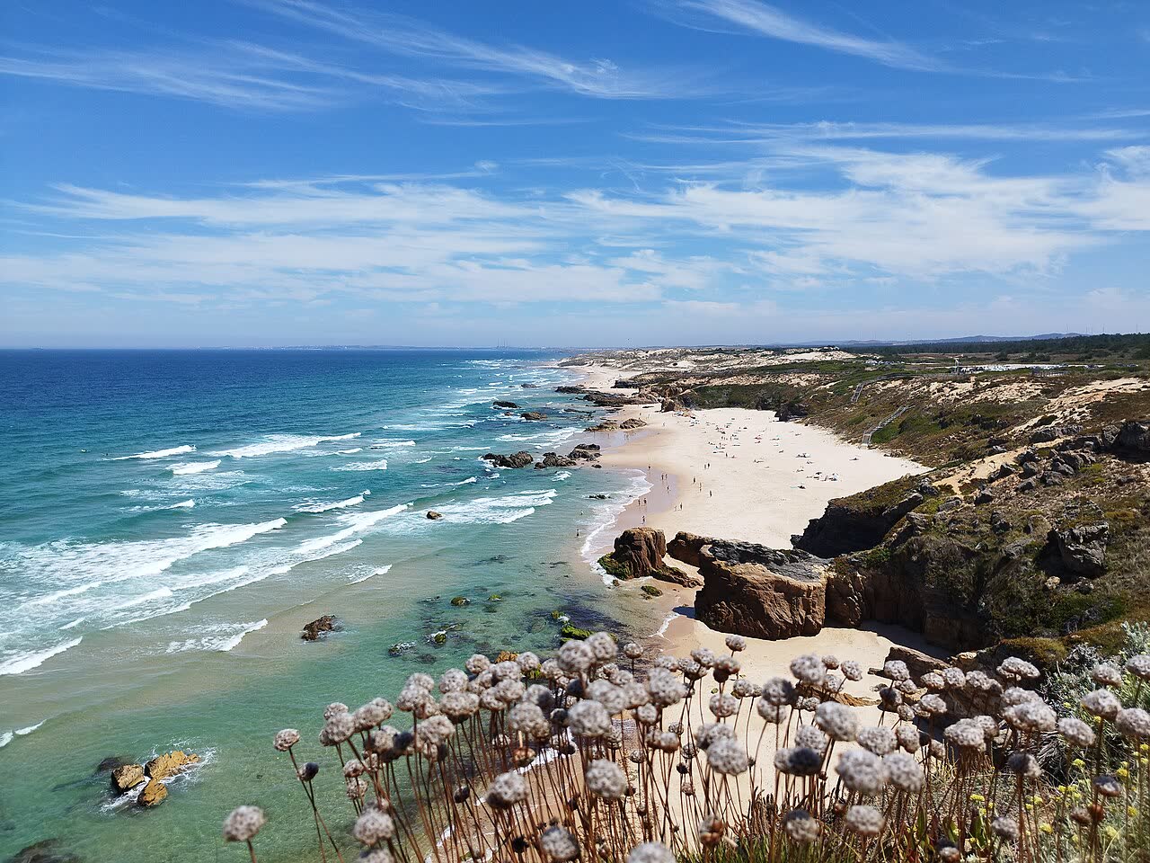
The Rota Vicentina is a network of about 750km of waymarked trails run by a local association. The Fishermen’s Trail, its coastal route, lies almost entirely inside the Southwest Alentejo and Vicentine Coast Natural Park. It runs from São Torpes beach through Porto Covo, Vila Nova de Milfontes, Zambujeira do Mar and Odeceixe, then down the Algarve’s west coast, round Cape St Vincent and east to Lagos, which it reached at the end of 2019.
You can walk it in either direction, and many people walk only part of it.
Fishermen’s Trail or Historical Way?
- Fishermen’s Trail: 226.5km in 13 stages along the coast. The association rates it as somewhat difficult, with 60 to 70% of it on sand.
- Historical Way (Caminho Histórico): 263km in 13 sections inland, on rural paths through villages, cork oak woods, hills and river valleys. It’s rated easy and is part of the GR11/E9 long-distance footpath.
- Which to choose: the coast for cliffs and beaches, or inland for firmer ground and quiet villages.
The 13 stages
Distances are approximate: the official total is 226.5km, but published stage figures vary a little. Sections are sometimes diverted after storms or cliff falls, so check the Rota Vicentina website first.
- São Torpes to Porto Covo: about 10km.
- Porto Covo to Vila Nova de Milfontes: about 20km, with long beach stretches past Ilha do Pessegueiro.
- Vila Nova de Milfontes to Almograve: about 15km.
- Almograve to Zambujeira do Mar: about 21.5km, past the Cabo Sardão lighthouse.
- Zambujeira do Mar to Odeceixe: about 18.5km, into the Algarve.
- Odeceixe to Aljezur: about 22.5km, the longest stage.
- Aljezur to Arrifana: about 17.5km, via Monte Clérigo.
- Arrifana to Carrapateira: about 20km along Bordeira beach, or 21.5km inland when the tide is high.
- Carrapateira to Vila do Bispo: about 16km.
- Vila do Bispo to Sagres: about 20.5km, round Cape St Vincent.
- Sagres to Salema: about 19.5km, along the south coast.
- Salema to Luz: about 12km.
- Luz to Lagos: about 11km, via Ponta da Piedade.
What walking it is like
Soft sand is the main challenge. It slows you down, so an 18 to 22km stage can take six or seven hours. The path often runs near the cliff edge, and the association says it isn’t suitable for anyone with vertigo or a fear of heights.
- Waymarking: blue and green marks, with signs for “follow”, “don’t follow”, left and right, in both directions.
- Shade: very little, so bring a hat and sunscreen even in spring.
- Food and water: not every stage passes a café. Most stage towns have a grocery, so carry lunch and at least 1.5 litres of water.
- Navigation: free GPX and KML tracks are on the Rota Vicentina website.
How many days to allow
With a rest day or two, the full trail takes about two weeks. Porto Covo to Odeceixe takes four days, and Odeceixe to Lagos another eight. With a weekend, base yourself in one town, walk a stage and take a taxi back.
When to go
The association recommends September to June, as summer is often above 30°C.
- March to June: the best months, with wildflowers on the dunes and long days.
- September and October: warm and settled, with quieter paths.
- November to February: the wettest months, with muddy paths and full streams.
- July and August: hot and exposed. Start at dawn and check for wildfire warnings.
Where to stay
There’s no network of walkers’ hostels as on the Camino, so you stay in guesthouses, small hotels, rural houses and campsites. Book ahead from May to September.
- Porto Covo: a whitewashed village and the usual start of the Alentejo stages.
- Vila Nova de Milfontes: the largest town on the route, with the most rooms and restaurants.
- Zambujeira do Mar: a small clifftop village.
- Odeceixe: the most northerly village in the Algarve, on the Seixe river.
- Aljezur: a castle town a few kilometres inland.
- Sagres: a surf town at the south-west tip.
- Smaller stops: Almograve, Carrapateira, Vila do Bispo, Salema and Luz have fewer rooms, so book these first.
Luggage transfers and packages
Most places to stay can arrange a luggage transfer if you ask when booking, and the Rota Vicentina website lists local taxi and transfer firms that work with the association, with taxi fares from about €1 per km. It also lists self-guided and guided packages from member companies, from a few days to two weeks, usually including rooms and luggage transfers.
Getting to the start and back
- From Lisbon: Rede Expressos coaches from Sete Rios serve Porto Covo, Vila Nova de Milfontes and Zambujeira do Mar, and some continue to Odeceixe and Aljezur. Porto Covo is a little over two hours away.
- To São Torpes: take a coach to Sines and a short taxi ride, or simply start at Porto Covo.
- Tickets: in small towns they are often sold in cafés or shops, and may need buying the day before.
- From Lagos: there’s a train station on the Algarve line and coaches to Lisbon, and Vamus Algarve buses run to Aljezur. Elsewhere buses are few, so walkers use taxis. See Portugal by bus.
Trail rules
- No wild camping: the trail is in a natural park, so use official campsites.
- On foot only: no bikes, and the association says trail running doesn’t suit the fragile ground. Vehicles are banned on the dunes.
- Groups: a maximum of 15 people.
- Dogs: keep them on a lead and clean up after them. Keep your distance from farm dogs guarding livestock.
- Stay on the path: don’t cut through dunes or plants. Some sections cross private land, where only walkers may pass.
- Cost: free, with no permits. The association welcomes donations.
Safety
- Cliffs: the cliffs are eroding and edges can give way. Stay well back, especially in wind or after rain.
- Heat: carry extra water on warm days, and avoid hot days with children.
- Tides: some beach crossings, such as Bordeira, can’t be passed at high tide or in big seas. Check tide times and use the inland alternative.
- Ticks: check yourself each evening, and see a doctor if you get a fever later.
- Before you go: leave your plans with your accommodation and check the warning map on the Rota Vicentina website. The emergency number is 112.
The best single stage
If you only have one day, walk Almograve to Zambujeira do Mar (about 21.5km). It passes the fishing harbour of Lapa das Pombas, dunes, pine woods and red sand cliffs to the Cabo Sardão lighthouse, where white storks nest on the sea stacks. Visit Portugal describes this as the only place in the world where they nest on sea rocks. They’re on their nests from late winter to early summer, so watch from the path, not the edge.
To shorten the day, stop at Entrada da Barca harbour, about 3.5km before Zambujeira, and take a taxi. For a half day, walk the first hour south from Porto Covo to the beach facing Ilha do Pessegueiro and back.
FAQ
How long is the Fishermen’s Trail?
It’s 226.5km in 13 stages from São Torpes, near Sines, to Lagos. Stages run from about 10km to 22.5km, and most people take about two weeks for the whole trail.
Is the Fishermen’s Trail difficult?
It’s rated somewhat difficult. There are no mountains, but most of the path is on sand, the stages are long and there’s little shade, so you need a decent level of fitness.
Do you need a permit to walk the Fishermen’s Trail?
No. It’s free and needs no permit. You only need to book your accommodation and any luggage transfers.
Can you camp on the Fishermen’s Trail?
Not in the wild, as the trail runs through a natural park. There are official campsites along the coast.
More: the Costa Vicentina, the best Alentejo beaches and hiking in Portugal.
Prices and details change, so please double-check before you travel. Spotted something out of date? Tell us in the groups.
Still got questions?
Ask 305,000+ travellers and locals in our free Facebook groups.